Table of Contents:
- What is Land Surveying?
- Different Types of Surveys
- The Importance of Land Surveying in Construction
- The Role of Technology in Modern Surveying
- Environmental Impact Assessment
- Legal Aspects and Regulations
What is Land Surveying?
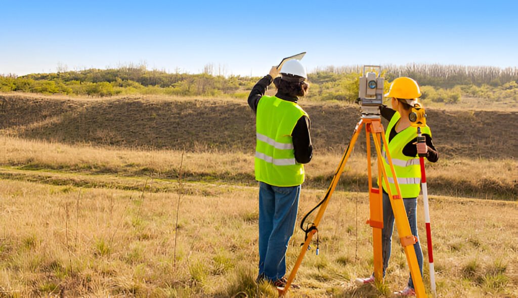
Land surveying is a critical process that involves measuring and mapping the Earth’s surface. Surveyors provide the foundation for property boundaries, construction projects, and utility setup by determining accurate measurements and mapping. These measurements are integral to various industries, ensuring infrastructure develops on solid and precise data. Comprehensive industry guides provide more about the technical aspects of land surveying.
Surveying encompasses many techniques and instruments, such as theodolites, GPS, and drones, that allow surveyors to gather accurate data efficiently. These tools are crucial in large-scale projects like urban planning, real estate development, and smaller yet equally significant ventures, such as landscaping and residential construction. Understanding the indispensability of land surveying fosters a greater appreciation for the precision involved in modern infrastructure development.
Different Types of Surveys
There are several types of land surveys, each serving a unique purpose:
- Boundary Surveys:Boundary surveys define the exact property lines and identify the actual boundaries of a plot. This type of survey is essential for resolving property disputes and ensuring that landowners fully understand their land’s limits.
- Topographic Surveys:Topographic surveys detail the natural and artificial features of the land, which are essential for construction and engineering projects. These surveys capture the land’s contours, elevations, and existing structures, providing a comprehensive overview for architects and engineers to design their projects accurately.
- Construction surveys provide data for the layout of roads, buildings, and other infrastructure. They ensure construction work proceeds according to the design plans, minimizing errors and preventing costly rework.
- Subdivision Surveys:Subdivision surveys divide the land into smaller parcels, often for development purposes. This type of survey is crucial for urban planners and developers aiming to create efficient and well-organized communities.
Each type of survey has distinct applications and benefits, contributing to the overall success of development projects. Understanding these various surveys helps stakeholders choose the appropriate method for their needs, facilitating better decision-making and project outcomes.
The Importance of Land Surveying in Construction
Construction projects rely heavily on precise land data to avoid costly mistakes and ensure compliance with zoning laws and regulations. For instance, during the planning stage of a new highway, surveyors gather information to design routes that minimize environmental impact and reduce project costs. Consequently, the role of surveyors becomes invaluable in successfully delivering such infrastructure. Accurate surveys help avoid issues like boundary disputes, incorrect site grading, and misalignment of structures.
Land surveying also ensures that construction projects adhere to local building codes and standards, reducing the risk of legal complications and fines. Surveyors enable engineers and architects to create functional and sustainable designs by providing accurate data. Moreover, during the construction phase, continuous surveying ensures that the project remains on track, identifying any deviations from the original plans and allowing for timely corrections.
The Role of Technology in Modern Surveying
Technological advancements have significantly improved the accuracy and efficiency of land surveying. GPS, drones, and 3D laser scanning allow faster data collection and more precise results. By leveraging these technologies, surveyors can cover larger areas in less time, reducing project duration and costs. A notable application can be seen in how technology integrates with surveying to enhance the quality and speed of surveys.
Innovations such as Geographic Information Systems (GIS) and Building Information Modeling (BIM) further enhance land surveying capabilities. GIS enables spatial data integration, providing detailed insights into land features and trends. BIM allows for creating digital representations of physical structures, facilitating better planning and collaboration among project stakeholders. These technological advancements improve the efficiency and accuracy of surveys and contribute to more informed decision-making processes.
Environmental Impact Assessment
Land surveying isn’t just about property lines and constructions but is also crucial in environmental impact assessments. Surveyors work with environmental scientists to ensure that new developments are sustainable and eco-friendly, providing data supporting responsible construction practices. Accurate land surveys help identify potential environmental risks, such as soil erosion, flooding, and habitat destruction, enabling developers to devise mitigation strategies.
Moreover, land surveying helps plan and implement green infrastructure, such as parks, roofs, and permeable pavements. These eco-friendly solutions reduce the environmental footprint of construction projects and promote long-term sustainability. By incorporating environmental considerations into the surveying process, surveyors play a vital role in fostering responsible development practices that benefit society and the planet.
Legal Aspects and Regulations
The legal implications of land surveying are vast. Surveying ensures compliance with local, state, and federal regulations, reducing the risk of legal disputes. Accurate surveys are critical for resolving boundary disputes, obtaining construction permits, and complying with zoning laws. For instance, establishing precise property lines can prevent conflicts between neighboring landowners and protect each party’s rights.
Surveying also plays a crucial role in land transactions, providing essential information for land titles, easements, and property deeds. By verifying the accuracy of land records, surveyors help facilitate smooth and transparent real estate transactions. Additionally, adherence to regulatory requirements ensures that construction projects meet safety standards, protecting the community’s well-being and minimizing liability risks for developers and contractors.


